Monday was President's Day, and Rob had the day off from work. I'm so glad because I wasn't feeling sick at all. We decided to drive around the southern half of the island. Last time we tried to do this, it was a very raining day, but today the weather was perfect, sunny and warm with fluffy white clouds.
Our first stop was Umatac, an interesting village full of history. In the local language, it is spelled Humatak. Ferdinand Magellan and his sailors brought first European contact to the island in 1521. It is thought they landed in Umatac Bay, but I just learned in further reading that the site is disputed, and might have been further north. I wish I could say that this is a good story, but it leaves me very disturbed. There was thievery, fighting, killing and burning of the settlement, not so different from stories of first visits in other places around the world. It wasn't mentioned in the article, but I'm guessing that the woman weren't safe during that visit either.
There is more about the story Magellan here: https://www.guampedia.com/ferdinand-magellan/
Read about the village of Umatak here: https://www.guampedia.com/umatac-humatak/
The road in the photo above is the main "highway" that goes around the island, and the main street of Umatak. We parked our car and got out and walked around town so we could see things more closely.
The little cement shelter was built in 1933, by an educator in Umatak or wanted to encourage reading. It was called the Outdoor Library. It was a place where residents could leave and exchange books.
A nice house by the water.
The school bus stop.
This place was probably lost it's roof in a Typhoon.
I wonder what kind of tree this is. It is both blooming and fruiting.
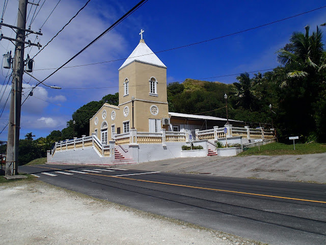
The Catholic church is the most dominate structure in the town. It sits right on the road. The white sign on the right of the photo reserves parking for the Bishop and Archbishop, in case they come to visit.
The doors were unlocked, so I peeked inside. The floors were shiny clean and the room was peacefully quiet. You can read more about the church in the article I linked above about Umatic Village.

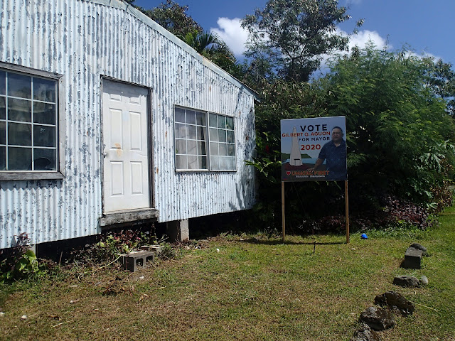
There was a 2020 political sign in front of this vacant building.
Then we found this little house in the photo below by the creek. It doesn't have a roof and is completely overrun by a beautiful variegated vine. The leaves are huge, and some of them are split like a monstera. You see these vines quite often around Guam. Any guesses on what this vine is?
Well, if you thought it looks similar to the tiny little Golden Pothos that sits in a pot on your end table, you are right. It is Golden Pothos. Just add some more light and humidity, and your houseplant might overrun your whole living room too.
Down in the little creek by the house of vines, giant taro leaves are growing.
The centerpiece of the whole town is this monument erected in memory of Ferdinand Magellan, and his visit in 1521. A little park is built around it, right in the center of the bay.

I love the giant old trees here. I wondered how long they have been here. There are ferns growing on the trunks all the way up into the heights.
These flowers are growing on 4 foot tall plants. The plants reminded me of some kind of Aloe, with long spike like leaves, but that is just guessing.
Across the street from the monument is the remains of the first Catholic church in town that was built out of stone. I think there were thatch and wood ones before that.
A strong earthquake caused it to collapse a long time ago.
As you look around you can see it was built to last, but nothing on earth lasts forever. The walls that remain are 3 - 4 feet thick and do look like something out of Spanish history. The Spanish tried to take over the world one island at a time.
They hurt a lot of people and changed culture while they did it. And this is what remains, crumbled walls covered with plants.
While walking around inside, a yellow butterfly landed on some Golden Pothos. I had never seen one like this before. I searched for butterflies on Guam in iNaturalist.com and found out it is a Common Yellow Grass. Here is a link that talks shows the whole life cycle of a Common Grass Yellow. You will want to see the photos of the pupa stage. You can see the yellow wing through the side of the chrysalis. https://butterflycircle.blogspot.com/2013/01/life-history-of-common-grass-yellow.html
The northern most point of the bay has a famous rock. You can barely see the top of it beyond the coconut palms in the photo below. It is called Fouha Rock. According to Chumoro folklore, this is where the world was created. If you want to learn more about it, follow the link.
https://www.guampedia.com/puntan-and-fuuna-gods-of-creation/
The road continues and crosses a river. When the village leaders needed to build a new bridge in the 1980's, they decided to give a nod to their European history and made it look a bit like London Bridge.
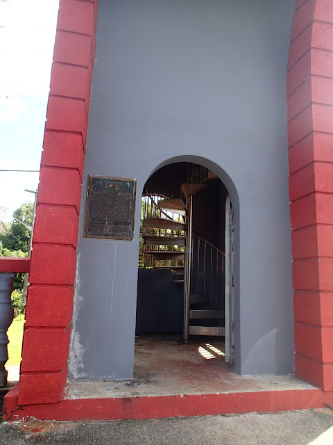
on the past visits we couldn't climb up to the top, because the spiral staircases had rusted out. The salty sea air rusts through all things metal very quickly. They have since been replaced with stainless steel stairways. Rob climbed up to the top, but I stopped halfway. Places like this make me really dizzy, so I went back down.
A nice Australian who was also on top took Rob's photograph. He has been traveling the world, and had just one more day on Guam. Two of these arches cross the street.


Comments
Post a Comment